Guiding you through the great outdoors. TRAIL VENTURES BC strives to produce accurate and detailed recreational trail maps and guidebooks for BC Chilliwack, South Chilcotin, Vancouver North Shore, Port Moody to Port Coquitlam, Stein Valley to Joffre Lakes and Kluane National Park in the Yukon.
TRAIL VENTURES BC
Guiding you through the great outdoors. TRAIL VENTURES BC strives to produce accurate and detailed recreational trail maps and guidebooks for BC Chilliwack, South Chilcotin, Vancouver North Shore, Port Moody to Port Coquitlam, Stein Valley to Joffre Lakes and Kluane National Park in the Yukon.
Previous slide
Next slide
BC Trail Maps & Kluane Trail Map
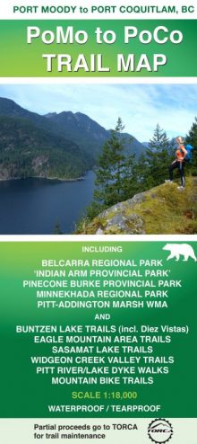
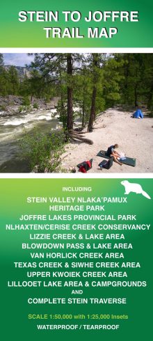
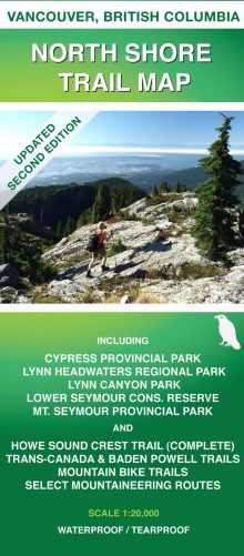
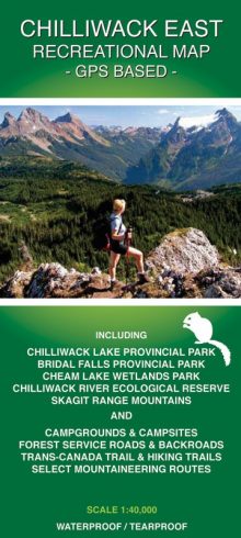
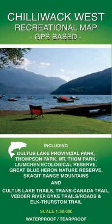
The most accurate and detailed BC trail maps and Kluane (Yukon) trail map available for the Southern Chilcotin Mountains (guidebook also), Chilliwack valley and mountains, Vancouver North Shore mountains, PoMo to PoCo (Port Moody to Port Coquitlam), Stein Valley to Joffre Lakes and Kluane National Park. Made for hiking, mountain biking, backpacking, horseback riding, mountaineering, snowshoeing, fishing, kayaking, rafting, canoeing, walking and camping BC trails and Kluane National Park trails (Yukon). Activities involving dirt bike, quad, four-wheel, snowmobile will benefit from the maps.
NEW!
June 2021: New Kluane Trail Map for Kluane National Park (Yukon) is available