East Chilliwack Hiking Trail Map
$14.95
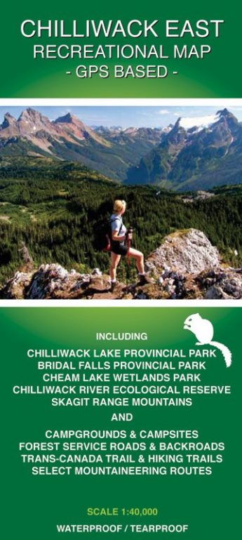
The first ever accurate GPS-based recreational map of the Chilliwack East (Skagit Range) area including access roads and highways, forest service roads, tracks, trails and mountaineering routes (MR). Roads and trails are qualified to enable best route finding.
Includes Chilliwack Lake Provincial Park, Bridal Veil Falls Provincial Park, Chilliwack River Ecological Reserve, and Cheam Lake Wetlands Regional Park. For camping, hiking, fishing, whitewater kayaking, rafting, paragliding, and mountaineering activities. Also for motorized activities including 4-wheeling, quad riding, and dirt biking.
Description
EAST CHILLIWACK HIKING TRAIL MAP – FEATURES & INFORMATION
The first GPS based, topographic Chilliwack hiking trail maps. Published in 2010 by Trail Ventures BC.
These Chilliwack hiking trail maps (including back roads) will appeal to hiking, mountaineering, horseback riding, mountain biking, snowshoeing, fishing, rafting and kayaking enthusiasts. These Chilliwack hiking trails & forest service road (FSR) maps are also useful for out-of-park activities involving dirtbike, quad & 4WD in back road areas such as Vedder Mountain and Chipmunk Creek.
EAST CHILLIWACK HIKING TRAIL MAP (Recreational Map) – GPS Based
- The first accurate Chilliwack hiking trail map (including back roads)
- All eastern Chilliwack hiking trails

Chilliwack East Map – Title
- 1:40,000 map
- Locator map & access information provided
- Covers ~935 sq. km (26 km N to S x 36 km W to E)
- Chilliwack Lake Provincial Park & trails
- Chilliwack River Ecological Reserve & trails
- Cheam Lake, Wetlands Regional Park, Bridal Falls Provincial Park, Upper Chilliwack River valley, Trans-Canada Trail, Cheam Peak Trail
- Post-Greendrop Trail (aka Lindeman Lake Trail & Greendrop Lake Trail), Flora Lake Trail
- Elk-Thurston Trail, Radium Lake Trail, Pierce Creek Trail
- Slesse Memorial Trail, Mt. McGuire Trail, Ford Mountain Trail, Williams Peak Trail, Lucky Four Mine Trail, Williamson Lake Trail & other trails
- Popular mountaineering (scrambling) routes
- First accurate Chilliwack forest service road (FSR) & back road map
- Chilliwack hiking trail map area stretches from the Canada-USA border to Jones Lake (S to N) and from Alison Pool to Custer Ridge/Silver Skagit Rd (W to E)
Additional Features of Both Chilliwack Maps:
- Topographic map with elevation colouring and hill shading
- UTM grid as well as latitude/longitude grid for easy GPS use
- Contour interval: 50m
- This Chilliwack hiking trail map was prepared with attention to detail. Chilliwack roads are rated according to road conditions: paved road, 2WD road, 2WD High Clearance road, and 4WD road. Likewise, trails and routes are rated to help guide users through the map area: track, primary trail, secondary trail, route and mountaineering route. This detail will be of particular use in navigation where trail or back road conditions vary significantly over short distances. In addition, small side creek and trailside pond positions, not indicated on any other maps, are shown for navigation purposes. Trail Ventures BC’s maps are based on extensive, detailed field surveys conducted on foot.
- Locations of Chilliwack campgrounds, campsites, footbridges, major creek crossings, bridges out, gates, barricades, boat launches, caves, historic sites, and put-in/take-out sites are shown.
- Trailhead locations are shown and UTM positions are given.
- Map projection/datum: NAD83. UTM gridlines plus gradations on the outside of map frame; and lat/long gradations on inside of map frame.
- Approximate Chilliwack glacier positions are shown where glaciers exist.
- Information about primary Chilliwack access, parks, roads, trails, activities, information sources, amenities, etc. on the back side of each map.
Additional information
| Weight | 108 g |
|---|---|
| Dimensions | 23.5 × 10.5 × 0.5 cm |
Store locations:
Mountain Equipment Co-op – 111 E 2nd Ave, Vancouver, BC (604-872-7858)
Mountain Equipment Co-op – #1-6121 200th Street, Langley, BC (604-534-4570)
Mountain Equipment Co-op – 212 Brooksbank Ave, North Vancouver, BC (604-990-4417)
International Travel Maps & Books – 12300 Bridgeport Road, Richmond, BC (604-273-1400)
Tourism Chilliwack Visitor Centre – 44150 Luckakuck Way, Chilliwack, BC (1-800-567-9535)
Valhalla Pure – 2-1707 Salton Rd., Abbotsford, BC (604-850-5523)
Hope Visitor Centre – 919 Water Avenue, Hope, BC (1-866-HOPEVIC)
Cultus Lake Provincial Park – Gatehouse
Chilliwack Lake Provincial Park – Office (trailer)
Mt. Waddington’s Outdoors – 5643 Vedder Rd., Chilliwack, BC (604-846-1984)
Wanderlust – 1929 West Fourth Ave., Vancouver, BC (604-739-2182)
Escape Route – 40222 Glenalder Pl, Squamish, BC (604-892-3228)
Escape Route – 113-4350 Lorimer Rd., Whistler, BC (604-938-3228)


