Vancouver North Shore Trail Map – Updated 2nd Edition
$17.95
UPDATED 2nd Edition! The first accurate and detailed trail map of the entire North Shore mountains area. This map is made for walking, hiking, mountain biking and mountaineering. All trails between Deep Cove, Horseshoe Bay and Porteau Cove are included. The entire Howe Sound Crest Trail is covered.
This edition includes several new trails and parking areas.
Includes Cypress Provincial Park, Lynn Headwaters Regional Park, Lynn Canyon Park, Mount Seymour Provincial Park and Lower Seymour Conservation Reserve. The entire Howe Sound Crest Trail, Baden Powell Trail and Trans-Canada Trail (partial) are covered. All mountain bike trails are also shown.
Description
VANCOUVER NORTH SHORE TRAIL MAP – FEATURES & INFORMATION
The most accurate and detailed topographic trail map produced for the North Shore area. Published in 2017 by Trail Ventures BC.
This Vancouver North Shore trail map will appeal to walking, hiking, mountain biking, and mountaineering enthusiasts. Use this Vancouver North Shore trail map to find trails to the best walks, hikes, rides, scrambles, lakes, viewpoints, waterfalls, picnic sites and old growth trees on the North Shore!
- The most accurate and detailed Vancouver North Shore trail map ever produced
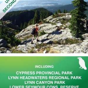
- Includes the first trail Vancouver North Shore trail map of the entire Howe Sound Crest Trail
- This double-sided map shows the main walking, hiking & biking trails on the entire North Shore
- Includes Sea-to-Sky section from Horseshoe Bay to Porteau Cove
- Waterproof & tear resistant – if cared for properly, this map will last for many years
- 1:20,000 scale
- Locator map & access roads shown
- Cypress Provincial Park, Lynn Headwaters Regional Park & Mt. Seymour Provincial Park included
- Lower Seymour Conservation Reserve, Capilano River Regional Park & Lynn Canyon Park included
- Porteau Cove Provincial Park, Nelson Canyon Park & Cypress Falls Park included
- Howe Sound Crest Trail (entire), Trans-Canada Trail & Baden Powell Trail (entire)
- Vancouver North Shore trail map area stretches from the Trans-Canada Hwy to Porteau Cove (S to N) and from Horseshoe Bay to Deep Cove (W to E)
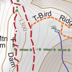
EXCEPTIONAL HIKING TRAIL DETAIL
Additional Features of Vancouver North Shore Trail Map:
- Topographic map with elevation colouring and hill shading
- UTM grid (with 1 km gridlines) as well as latitude/longitude grid for easy GPS use
- Contour interval: 20m
- All backroads, tracks, trails, routes and mountaineering routes were GPSed from 2010 to 2017
- Mountain bike trails are shown according to difficulty (green, blue & black)
- This Vancouver North Shore trail map was prepared with attention to detail. All roads are rated according to road
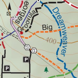
EXCEPTIONAL MOUNTAIN BIKE TRAIL DETAIL
conditions: paved road, 2WD road, 2WD High Clearance road, and 4WD road. Likewise, trails and routes are rated to help guide users through the map area: track, primary trail, secondary trail, route and mountaineering route. In addition, small side creek and trailside pond positions, not indicated on any other maps, are shown for navigation purposes. Trail Ventures BC’s maps are based on extensive, detailed field surveys conducted on foot
- Locations of parking, campgrounds, backcountry campsites, backcountry shelters, picnic sites, outhouses/restrooms, footbridges, waterfalls, viewpoints, major creek crossings, gates, historic sites, information boards, fish hatcheries and old growth trees are shown
- Map projection/datum: NAD83. UTM gridlines plus gradations on the outside of map frame; and lat/long gradations on inside of map frame
- General information regarding activities are given for all parks, reserves and recreational areas
- Important phone numbers and web sites are listed
- Features included in this map; North Shore mountains, Deep Cove, Horseshoe Bay, Porteau Cove, Howe Sound Crest Trail, Cypress Provincial Park, Lynn Headwaters Regional Park, Lynn Canyon Park, Mount Seymour Provincial Park, Lower Seymour Conservation Reserve, Baden Powell Trail, Trans-Canada Trail, Sea-to-Sky, Capilano River Regional Park, Porteau Cove Provincial Park, Nelson Canyon Park, Cypress Falls Park, Grouse Grind, Quarry Rock, Mt. Seymour Trail, Dog Mountain Trail, Norvan Falls, Cedar Tree Trail, Kennedy Falls Trail, BCMC Trail, Crown Mountain Trail, Goat Mountain Trail, Lynn Canyon, Lynn Peak, Pump Peak, Rice Lake Trail, Headwaters Trail, Lower Lynn Loop Trail, Hanes Valley Trail, Mystery Lake, Mystery Peak, Cedars Mill Trail, Capilano Suspension Bridge, Rice Lake, Mt. Fromme, Mt, Fromme Trail, Twin Bridges, Fisherman’s Trail, St. George’s Trail’s, Per Gynt Trail, Deep Cove, Homestead Trail, Lynn Valley, Elsay Lake Trail, Brockton Peak, Baden Powell Trail, Goldie Lake, Flower Lake, Old Buck Trail, Varley Trail, Cedars Mill Loop, Mount Seymour, Three Chop Trail, Mt. Elsay, Twin Falls, Hyannis Creek, Mystery Creek, Mosquito Creek Trail, South Needle, Grouse Mountain, Dog Mountain Trail, Seymour Valley Trail, Lynn Valley, Little Goat Mountain, Alpine Trail, Dinkey Peak Trail, Second Lake, Suicide Bluffs Trail, Indian Arm Trail, Skyline Trail, Mountain Highway, De Pencier Bluffs, Goat Mountain, Crown Mountain, MacKay Creek Trail, Lions Bay Trails, Porteau Cove Trails, Horseshoe Bay Trails, Deep Cove Trails, West Vancouver Trails, North Vancouver Trails, Seymour Trails, Cypress Trails, Fromme Trails, Grouse Mountain Trails, North Shore Trails, Lynn Headwaters Connector Trail,Big Cedar Trail, Simic’s Trail, Old BCMC Trail, Larsen Trail, Cascades Trail, St. Mary’s Trail, Big Skid Trail, Dreamweaver Trail, Executioner Trail, 7th Secret Trail, Pile of Rocks Trail, Upper Oilcan Trail, Leopard Trail, Crinkum Crankum Trail, Kirkford Trail, Groovula Trail, Boundary Trail, Digger Trail, Braemar Trail, Pennzoil Trail, Dempsey Trail, Lower Crippler Trail, Kilmer Trail, Quarry Court Trail, Lower Skull Trail, Skull Trail, Pink Starfish Trail, Jerry Rig Trail, Air Supply Trail, Lower Oilcan Trail, Grannies Trail, Upper Crippler Trail, Expresso Trail, Pipeline Trail, Ladies Only Trail, Lower Ladies Trail, Cedar Trail, Roadside Attraction Trail, Griffen Trail, Lower Griffen Trail, Bobsled Trail, Floppy Bunny Trail, Sticks & Stones Trail, Academy Trail, Rapid Transit Trail, RT Connector Trail, Water Towers Trail, King of the Shore Trail, Lynn Peak Trail, Varley Trail, Circuit 8 Trail, Seymour Valley Trailway, Twin Bridges Trail, Falls Trail, Richard Juryn Trail, Hyannis Trail, Bridle Path, Powerline Trail, Mystery Creek Trail, Ridge Runner Trail, Bottle Top Trail, Greenland Trail, Ned’s Atomic Dustbin Trail, TNT Trail, CBC Trail, Lumpy Gravy Trail, Cabin Trail, Dale’s Trail, Dirty Diapers Trail, Dustbin Trail, Mushroom Trail, Incline Trail, Corkscrew Trail, Forever After Trail, Mary Kirk Access Trail, Slippery Salamander Trail, Cardiac Bypass Trail, Applicator Trail, C. Buster Trail, Asian Adonis, Good Sir Martin Trail, Shorn Scrotum Trail, Adonis Buster Trail, Penny Lane Trail, Forever After Trail, Salamander Trail, High School League Trail, HSL Trail, Blair Range Access Trail, Golf Course Trail, Perimeter Trail, Express Trail, Express Bypass Trail, Boogieman Trail, Pangor Trail, Severed Dick Trail, John Deer Trail, Old Buck Trail, Old Buck Access Trail, Pingu Trail, Salvation Trail, NSHA Loop Trail, Quarry Rock, Goldie Lake Loop Trail, Flower Lake Loop Trail, Mystery Lake Trail, Haines Valley Trail, Lynn Lake Trail Route, Coliseum Mountain Trail, Seymour Valley Lookout Trail, Lynn Peaks Trail Route, Dam Mountain, Dam Mountain Trail, Thunderbird Ridge Trail, Eric The Red Trail, Alpine Trail, Ridge Trail, Goat Mountain Trail, Goat Ridge Trail, Hydraulic Connector Trail, Mid Valley Lookout, Oldgrowth Trail, Coho Trail, Seymour River Hatchery, Seymour Lake Dam, Seymour Lake, Cleveland Dam, Vicar Lakes Route, Mt. Bishop, Mt. Burwell, See More Stumps Trail, First Pump, Tim Jones Peak, Runner Peak, Howe Sound Crest Trail, HSCT, Unnecessary Mountain Trail, Binkert Trail, Lions, West Lion, East Lion, Mt. Harvey Trail, Harvey’s Pup Climbers Access Trail, Mt. Brunswick Trail, Enchantment Pass, Magnesia Meadows, Brunswick Lake, Hanover Lake, Mt. Hanover, Hat Mountain, Hat Pass, Mt. Windsor, Deeks Peak, Deeks Lake, Phi Alpha Falls, Deeks Lake Trail, Deeks Peak Trail, Kallahne Lake, Kallahne Lake Trail, Porteau Road, Whyte Lake Trail, Trans Canada Trail, TCT, Eagle Bluff, Donut Rock Trail, Cougar Lakes, Owen Lake, Sam Lake, Cabin Lake, Yew Lake Lookout, Black Mountain, Cypress Creek Lodge, Mt. Strachan Access Road, Yew Lake Interpretive Trail, Cypress Falls Park, Whyte Lake Park, Quarry Picnic Site, Skyline Trail, Eagle Lake Road, BLT Trail, Wutang Trail, Sex Girl Trail, S&M Connector Trail, Tall Cans Trail, SLT Trail, Roach Hit Trail, Roach Clip Trail, Upper Tall Cans Trail, 5th Horseman Trail, Wild Cherry Trail, Pull Tab Trail, Slippery Canoe Trail, Sex Boy Trail, Fern Trail, Shoreplay Trail, SGS Trail, Antagonizer Trail, Blind Skier Trail, Old Growth Conservancy, Firehose Trail, Paul Hogan Trail, Lower Paul Hogan Trail, Cypress Bowl, Cypress Bowl Road, Reaper Trail, Coiler Trail, Old Forks Trail, Jersey Shore Trail, Meat Sweats Trail, Stupid Grouse Trail, Millstream Trail, Brewis Trail, Old Brewis Trail, 10 min Trail, Hollyburn Lodge, First Lake, Sitzmark Trail, Burfield Trail, Hollyburn Trail, Third Lake, Fourth Lake, Fifth Lake, Sixth Lake, West Lake, Hollyburn Ridge, Old Strachan Trail, Hollyburn Mountain Trail, Blue Gentian Lake, Brothers Creek Trail, Lost Lake Trail, Lost Lake, Crossover Trail, Incline Trail, Shields Incline Railway, Ballantree Trail, Ballantree Park, Capilano River trails, Capilano Pacific Trail, Shinglebolt Trail, Palisades Trail, Capilano Fish Hatchery, Capilano Suspension Bridge, Twin Falls Bridge, Pipeline Bridge, Pipe Bridge, Sea to Sky Trail, Diamond Trail, Hyannis Point, Lynn Canyon Suspension Bridge, Rice Lake, Inter River Park, Lynn Canyon Park, Bear Trail, Beaver Trail, Lillooet Road, Lynn Valley Road, Rice Lake Road, Lynn Headwaters Regional Park, Seymour Conservation Reserve, Mt. Seymour Provincial Park, Cypress Provincial Park, Highview Lookout, T-33 Crash Site, Mt. Strachan Trail, Strachan Meadows, Bowen Lookout, Sunset Beach Trail, St. Marks Summit, Unnecessary Mountain, Strachan Lake, Emily Lake, Grouse Mountain Skyride, Peak Chalet, Blue Grouse Lake, Grouse Mountain Lodge, Grouse Mountain Regional Park, Kennedy Lake, Grouse Mountain Hwy, Old GMH Road, Mosquito Creek, Dog Mountain, Mt. Seymour Lodge, Mt. Seymour Road, Indian River Drive, Lynn Creek, Seymour River, mountain bike trails, walks, hikes, rides, scrambles, lakes, viewpoints, waterfalls, picnic sites and old growth trees
Additional information
| Weight | 104 g |
|---|---|
| Dimensions | 23.5 × 10.5 × 0.5 cm |
Store locations:
Mountain Equipment Co-op – 111 E 2nd AveVancouver, BC (604-872-7858)
Mountain Equipment Co-op – 212 Brooksbank Ave, North Vancouver, BC (604-990-4417)
Mountain Equipment Co-op – #1-6121 200th Street, Langley, BC (604-534-4570)
Grouse Mountain Resorts – 6400 Nancy Greene Way, North Vancouver, BC (604-984-0661)
International Travel Maps & Books – 12300 Bridgeport Road, Richmond, BC (604-273-1400)
Valhalla Pure – 805-1200 Hunter Place, Squamish, BC (604-892-9092)
Porteau Cove Provincial Park Gatehouse – Porteau Cove, BC (604-689-9025)
Distance Runwear – 4800 Main St, Vancouver, BC (604-737-6982)
Distance Runwear – 1328 Main St, North Vancouver, BC (604-770-2484)
Escape Route – 113-4350 Lorimer Rd., Whistler, BC (604-938-3228)
Valhalla Pure – 2-1707 Salton Rd., Abbotsford, BC (604-850-5523)
Armchair Books – 4205 Village Square, Whistler, BC (604-932-5557)
Mt Seymour Trading Post – 1700 Mt Seymour Road, North Vancouver, BC (604-986-2261)
Kintec – 975 Marine Drive, North Vancouver, BC (604-980-5633)
The End of the Line General Store – 4193 Lynn Valley Road, North Vancouver, BC (604-904-2366)
Lynn Canyon Ecology Centre – 3663 Park Road, Lynn Canyon Park, North Vancouver, BC (604-990-3755)
Wanderlust – 1929 West Fourth Ave., Vancouver, BC (604-739-2182)
Escape Route – 40222 Glenalder Pl, Squamish, BC (604-892-3228)
Valhalla Pure Outfitters – 201 Bewicke Ave., North Vancouver, BC (604-376-4766)

